Field Report ~ SAFARI 2000 Field Report ~ SAFARI 2000
Page 2 of 4
|
|
(Click here to go to the next page of photos.)
|
|
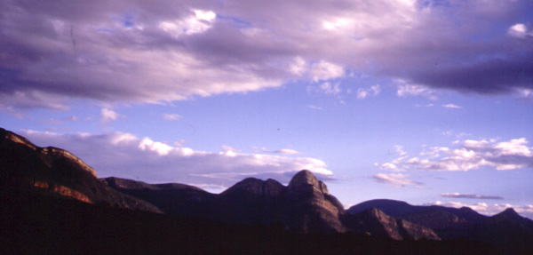
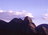
Northern Extent of the Drakensberge
| |
|
After the meeting, Tim Suttles from Goddard, Bob Cook from ORNL, Phil Russell
from Ames, and myself drove through this part of the Drakensberge on the
way to Skukuza via Blydepoort. This is Voortrekker country, at the
edge of the Highveld.
|  | |
|
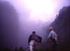
God's Window
| |
|
Bob and Tim look over the edge. Not much to see, too many clouds.
Great view of the Lowveld when they part. The San man of "The Gods
Must be Crazy" throws the pop bottle (which fell from the sky and
konked his buddy) over the edge of his world near here.
|  | |
|
Jungle Explorer
| |
|
Between the Highveld & Lowveld, these mountians rise
at the edge of a great continental plateau. This range of cliffs is the first
obstacle that humid air from the Indian
Ocean is pushed over as it moves up to the interior.
As the air rises, it gives up moisture, and a small rainforest grows
at this dramatic boundary.
|  | |
|
Oom Paul Kruger
| |
|
A bust of Uncle Paul Kruger looks over an entrance to the park he
established over 100 years ago. That's what I call stubborn practical
foresight.
We are crossing the Sabie river, which had recently flooded. At
the meeting, the Park's representative showed videos of the floodwaters
up to Oom Paul's chin. Note the guard rail of the bridge, ruined by
big debris in the fast waters.
|  | |
|
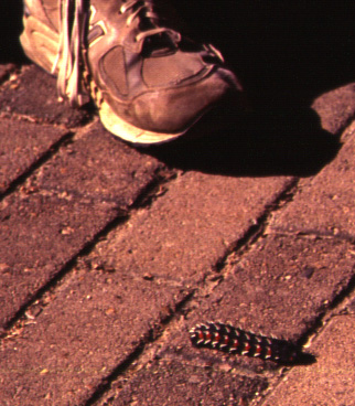
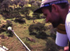
A Mopani Worm (I Think)
| |
|
I have had identified for me cooked caterpillars served as beer
munchies that must have looked like this fella before being saut�ed.
I did not partake, so I can't comment on how they taste. I'll eat a
lot of weird-looking things, especially out of the oceans, but I won't
eat bugs. Blechh!
|  | |
|
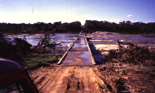
Low Water Bridge to Skukuza Airport
| |
|
This bridge will have nary a trickle under it come winter. The floodwaters
were over the red roof of the van at this point. Debris piled up on
the shore tells the story. I and my field team
will have to cross this bridge early every morning on our way the experiment
site I picked out on this trip.
|  | |
|
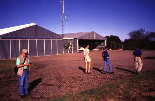
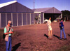
MISR Site at Skukuza Airport
| |
|
There is a large grassy area adjacent to these hangars at the end of the
runway at
Skukuza Airport. The trees have been cleared back far enough for our
instruments
to ge a good enough view of the sky down to the horizon. There is also
a fence around the area to keep the hyenas out (if someone doesn't leave
the gate open). From left to right: Tim, Park Ranger in charge of research
coordination Holger Eckhardt, Bob, and Phil.
|  | |
|
We Make a Friend on the Way Back
| |
|
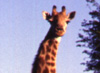
Game viewing is the thing to do at Skukuza. We met this fellow on the
way back to camp from the airport. He did not seem too concerned about
the van full of gung-ho scientists in front of him leaning out of the
windows and snapping off photos. We will certainly keep our cameras
handy during the experiment!
|  | |
|
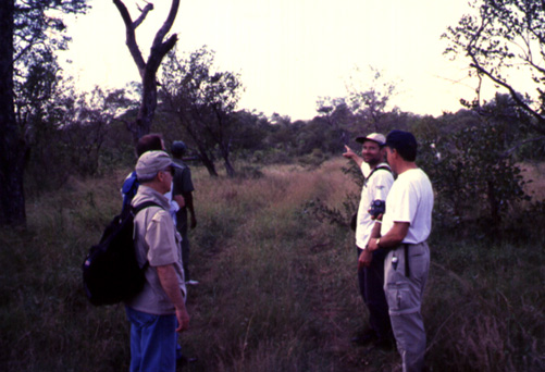
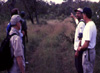
Getting to the Skukuza SAVE Tower
| |
|
Besides the patch at the airport, another site of interest to MISR
is the SAVE tower that Jeff Privette from GSFC had installed. I'll
try to mount PARABOLA on it. We're preparing to walk to the tower,
about 1.5 km from the graded dirt road we came in on. We were escorted
by an armed game guard (who's
name was unpronounceable by mere mortals), and joined by Niall Hanan from
Colorado State who installs & maintains instruments on the tower.
|  | |
|
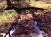
Somebody Got Stuck Here
| |
|
Someone got a vehicle stuck real good here. This is why we were walking.
If your LandRover gets mired, it's an 11km walk back to the camp, and
you'd better hope your game guard is a good shot.
The hike in was quite squishy for people, too. The tree was knocked over
by an elephant to get at yummy leaves on top. Fairly impassable
for vehicles.
|  | |
|
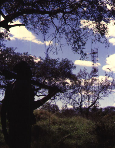
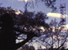
Our Game Guard Looks On
| |
|
We pause before approaching the tower for a Kodak Photo Opportunity.
Our game guard slings his rifle over his shoulder. The bore on that cannon
looks to be about a half inch. The tower is situated in the middle of
a wooded grassland.
|  | |
|
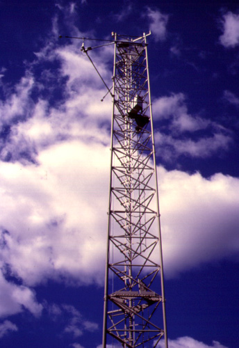
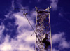
Upper Part of Skukuza Tower
| |
|
The tower is about 18m tall, and has no guy wires. The concrete plinth
it is bolted to takes up a minimum of ground area extending out from the
foot of tower. These factors are important for PARABOLA. Note the instrument
booms. There three platforms including the one at the top, and a central
ladder. Fun climbing (NOT!), and it sways in the wind (GULP!).
|  | |
|
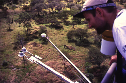
View From the Top
| |
|
Niall looks down upon his radiometric instruments. Left to right:
InfraRed pyranometer, VisNIR Pyranometer, VisNIR albedometer. The
albedometer has a clear dome on the bottom of it as well. The ratio
of the upwelling radiation hemispheric field to the downwelling
yields broad-band albedo, typically a value between 0 and 1.
Terra instruments estimate this quantity,
and every time Terra flies over this site, a comparison will be made.
|  | |
|
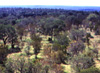
A Typical View of the Countryside
| |
|
This view is like any other from the top of the tower. This site was
chosen for the tower for just that reason. Terra instruments
see large plots of land. Ground measurements, which must be made in smaller
areas, are carefully chosen to represent the larger area visible from space.
|  | |
|
Look Out Below!
| |
|
Phil, Tim, and Bob crane their necks to say "cheese!". This view is
also typical of the area immediate to the bottom of the tower.
|  | |
|
(Click here to go to the next page of photos.)
|