Field Report ~ SAFARI 2000 Field Report ~ SAFARI 2000
Page 4 of 4
|
|
(Click here to go back to the first page of photos.)
|
|
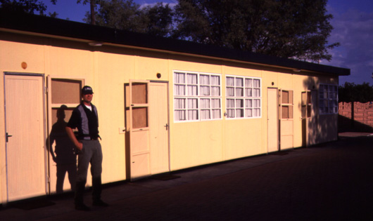
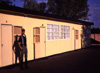
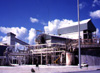
Our Accomodations for the Duration
| |
|
At the kind insistence of Frank Eckardt of the University of Botswana,
and the diligent urging of Fatima Ferraz, remote sensing geologist for a
division of DeBeers, I decided to visit Sua Pan after Skukuza.
Frank was my guide, and introduced me to the staff of Botswana Ash, a
potash mine out there, nicknamed "Botash". DeBeers is part-owner of the
mine. These are the dorms originally built for visitors, and are now
also available for tourists.
|  | |
|
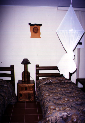
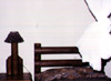
This is a Mozzie Net
| |
|
The dorm rooms have two single beds each, complete with mosquito nets.
Two rooms share one bathroom with a shower. There is also a heat-pump
for each room. Quite civilized, and the only decent accommodations for
quite a few trackless kilometers.
|  | |
|
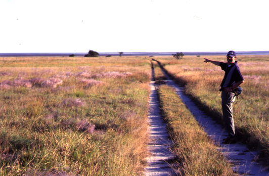
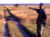
A Walk Out the Back Door
| |
|
Just behind the dorms, this track makes its way to the southern shore of
the peninsula that the mine occupies. The Botash mine is about 3km away,
on the northern shore. Frank is pointing almost due south.
|  | |
|
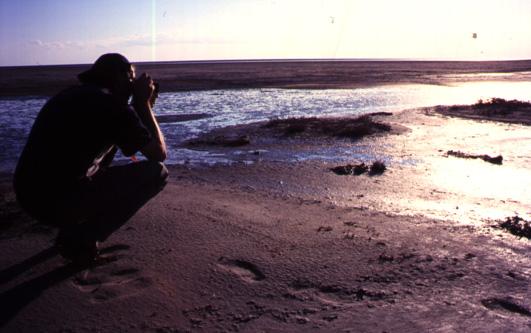
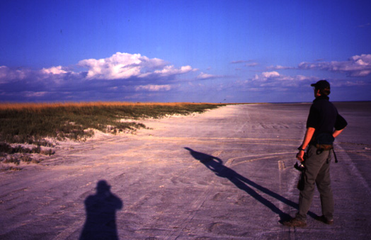
The Pan Man in His Element
| |
|
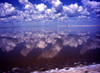
Frank makes for an arty photo while trying for a fancy shot of his own.
We have walked about 1km south from the shore, and the pan is quite muddy
from the summer rains. Should be dry by winter, I am told.
|  | |
|
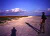
At the Shore
| |
|
This photo gives you an idea of the scale of the place. There is nothing
on the horizon in all directions. The peninsula is uniformly covered
in tall grasses, and the pan is nice and white (when dry). It's the top
reflecting millimeters of the pan that I am interested in. The Botash
folks want what lies below.
|  | |
|
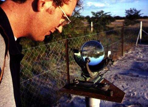
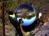
What IS That Gizmo?
| |
|
This is a solometer. It focuses sunlight on a paper strip marked off in
hours. The sunlight burns a track into the paper and the width of the burn
tells what the relative strength of the sunlight was. The Botash mine
uses solar power for evaporation ponds, and is able to correlate the
solometer record and weather conditions with evaporation rates.
This is the ideal instrument - no moving parts, no batteries, and
no finicky optics. Note the celestial alignment of the holder.
|  | |
|
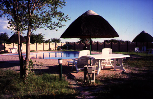
Not Entirely Without Comforts
| |
|
The dorms also have an adjacent pool, lounge, and dining hall connected
by paved paths. We will be staying here for the Aug/Sep campaign, but
the temps will be just above freezing at night - so no swimming. Shucks.
|  | |
|
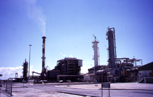
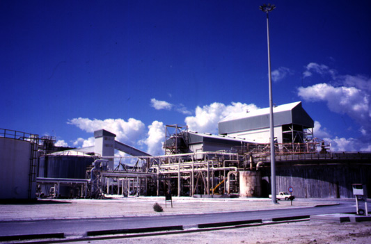
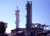
The Botash Plant
| |
|
The mine requires CO2 in its processes, and so burns coal in a co-generation
facility connected to the southern African power grid. They have a high-tension
line stretching all the way to the power stations of South Africa. Also visible are
towers for various chemical processing beds.
|  | |
|
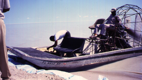
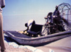
Where Did They Get THAT?
| |
|
Look closely for the Florida registration tag on the bow. The mine pumps
brine out from under the pan into huge evaporation ponds. When the wet season
fills the pan with water, (1.5 to 2m this year) the staff uses airboats
to get out to the wells.
|  | |
|
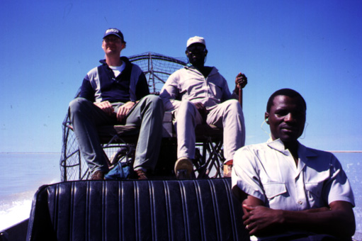
Whee-haaa!
| |
|
The northern end of Sua Pan has 98 wells feeding
salty brine to the evaporation ponds. We are on our way to one
of them, despite the greatest inflow of water to the pan in many
years. Frank enjoys the ride from the copilot's seat. Below on
the right is Blazer Ntshiamisang, the environmental officer for the mine
and our host.
|  | |
|
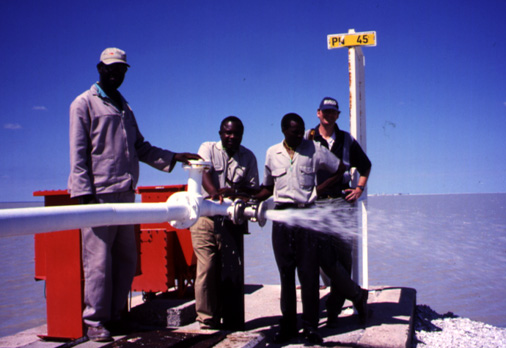
Well Island
| |
|
There is a 1km grid of these well islands for 200 square kilometers across
the northern end of Sua Pan. The installed pumping capacity of the mine
is 2400 cubic meters per hour. Blazer had this test port opened for me
so I might taste the raw brine from 30m below my feet. Mmm, salty & soapy.
The plant is just visible on the horizon in the backround.
|  | |
|
Quite an Operation
| |
|
The Botash mine uses a process developed in my home state,
Southern California,
at Searles Dry Lake in Trona. It is the major local supplier of salt and
potash products for all of sub-Saharan Africa, and competes directly
with American producers (who dump their excess production into the
foreign market, making business difficult for these guys).
|  | |
|
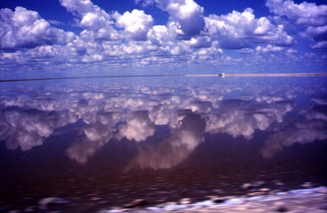
Evaporation Pond at the Botash Mine
| |
|
I couldn't pass up this photo opportunity. I just rolled down the window
of the truck. Note the speed-blurred shore.
These evaporation ponds are over 22 square kilometers in extent,
and quite visible to MISR orbiting 705 km overhead.
As water evaporates from the ponds, sodium chloride (table salt)
crystallizes into solid form and is skimmed off for washing and milling.
The remaining concentrated liquid is feedstock for the potash process.
|  | |
|
(Click here to go back to the first page of photos.)
|