|
||
| Mark Helmlinger visited southern Africa from July 24 to August 7, 1999 to attend a planning workshop for the SAFARI 2000 experiment as well as visit potential experiment sites. SAFARI 2000 (http://safari.gecp.virginia.edu), the Southern African Regional Science Initiative, is a regional climate experiment with an intensive field campaign to be conducted in August 2000 by African and U.S. researchers. On the U.S. side, it will involve participants from many EOS teams, including MISR. It was determined that the MISR Calibration/Validation Team might attempt to acquire field measurements at the Etosha Pan of the type needed to calibrate MISR and AirMISR, hence Mark's drive to northern Namibia. AirMISR will fly over many of the vegetation and other sites that will be measured by other ground teams. | ||
Click here to download a copy of Mark's detailed trip report (PDF format, 92KB). Below are the figures, together with captions, referred to in the detailed trip report, followed by a selection of other favorite photos from the trip. Clicking on the small images will load larger versions. To allow for slower web connections, none is larger than 180KB. For high resolution (and much larger) versions of any of these images, contact Mark directly. |
||
Figures/diagrams for Mark's trip report |
||
| Figure 1. AVHRR mosaic of southern Africa | ||
| The original working image has a resolution of 1km, similar to MISR's Global Mode and other EOS platform instrument's spatial resolutions. Notice two large white features, dry lakebeds. These are locally called salt pans, and are potential MISR experiment sites for SAFARI2000. |  |
|
| Figure 2. Etosha and Magkadigkadi as viewed from space | ||
| My colleagues at the Gaborone planning meeting convinced me that Etosha was the better of the two salt pans for calibrating MISR and AirMISR. Thus my adventure to this site began. |  |
|
| Figure 3. Road map of my trip | ||
| Starting in Johannesburg, winding through Gaborone, crossing the Kalihari, through Windhoek to Etosha, and making a loop through the Namib desert and Skeleton Coast before returning. Here I go, Indiana Jones, ready for adventure... |  |
|
| Figure 4. Winter image of Etosha Pan | ||
| Winter is the dry season at Etosha. Produced by Johan le Roux, this greatly stretched false-color image shows the water settling and erosion patterns of the dry pan. The scale of the image is deceptive. One must remember that the pan is 4590 square kilometers in area and 120 x 72 km in extent. |  |
|
| Figure 5. Summer image of Etosha Pan | ||
| Also produced by Johan le Roux, this greatly stretched false-color image of Landsat data shows how water fills into the pan during summer rains. Finding large dry areas is not as difficult as it looks because even the smallest dry spot in this image is HUGE on the ground. |  |
|
| Figure 6. Experiment plan logistics | ||
| This map details our proposed site and access route and shows the distance between a possible MISR SAFARI2000 camp and Okaukuejo, (the nearest town), to be 20 km. Just over the horizon from the nearest Internet connection . . . |  |
|
| Figure 7. Okaukuejo & Okondeka watering holes | ||
| MISR will have to work away from watering holes, as the animals and the tourists they bring are quite valued. An electric fence may be needed to keep out predators (drawn here to scale). |  |
|
| Figure 8. Namibian coast from space | ||
| Shows features and towns we identified along the Skeleton Coast, after braving the Namib Desert. Because the offshore waters are so cold, this is one of the most arid regions on Earth. It is also one of the most ancient continental shelves on our planet. Thanks Dr. Frank, for preparing this summary. |  |
|
| Figure 9. Pan sediments spectra | ||
| Laboratory reflectance spectra of pan surface samples. This is why we like to use such surfaces as targets. They are bright in the blue (about 440nm). The rest of the spectrum is generally dirt-like, but the brighter in the blue part of the visible spectrum that soils are, generally the whiter they look to the eye. Sometimes these targets reflect enough in the UV (beyond blue) to require sunblock under the chin and nose! |  |
|
| Figure 10. Apollo photo of Etosha | ||
| Most of the Namibian population live in the north of their country, as it is less arid there. They support themselves by raising cattle, which feed upon the grass. However, crossing the border the population density suddenly decreases. This results in less cattle and more vegetation growth, an effect which can be seen from space as a contrast at the border. The Etosha (salt) Pan is also shown to the southeast. |  |
|
| Figure 11. The MISR validation team | ||
| This is the crew who will be waiting my return from SAFARI2000, eager to look at the data collected there. Back row: Larry Di Girolamo, Stuart McDermid, Bob Woodhouse, Jim Conel, Bill Ledeboer, John Martonchik, Ralph Kahn. Middle row: Barbara Gaitley, Carol Bruegge, Nadine Chrien, Wedad Abdou. Bottom: Mark Helmlinger (me!). |  |
|
A selection of other photos from the trip |
||
| Watering hole at Etosha headquarters, Okaukuejo, Namibia | ||
| Johan le Roux, Remote Sensing and GIS Officer of the Etosha Ecological Institute casually asked me to wait here while he took care of a bit of ranger business before our trip out to the pan. Very shrewd, Johan. | 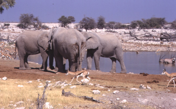 |
|
| Zebras crossing just outside of Etosha National Park | ||
| Note soil and plant types. We are outside of the park and just south of the main entrance into Okaukuejo - I know because the roads are not paved inside the park. Driving after dark or before dawn within the park is not permitted to protect the wildlife and you. | 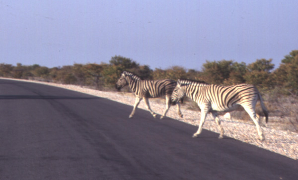 |
|
| Alluvial fan on Skeleton Coast just south of Cape Cross | ||
| Note how homogeneous the fan is over a one meter area, and to the horizon. Not as white as a dry lakebed, but suitable as a calibration target. Dr. Frank Eckardt tells me it takes hundreds of millions of years of undisturbed gradual erosion to produce such features. | 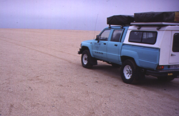 |
|
| Two school girls outside of Botswana Parliament, Gaborone | ||
| They are english students, and immediately recognized where I was from; when I said “L.A.", they said “Oh!, Hollywood!". This photo could not have been taken as easily in the other countries I visited for various cultural and political reasons. | 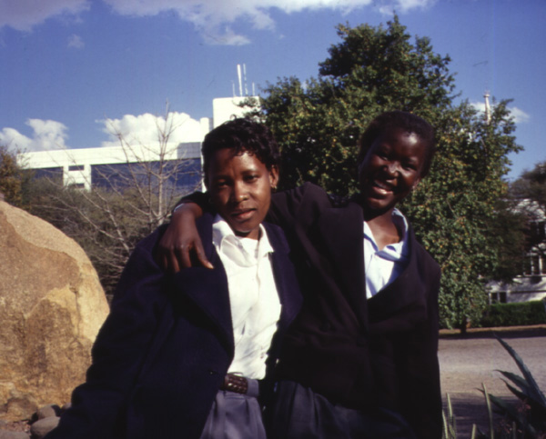 |
|
| Scenery north of Brandburg, in the Namib Desert | ||
| Brandburg is a lone granitic intrusion. Situated on the eastern edge of the Namib, it rises thousands of meters above the desert floor and appears quite circular from above, with a diameter of some 40km. In the photo, note crystal structures of the darker dolorite dike and ancient weathered granites. Identical dolorites are found on the eastern coast of Brazil. | 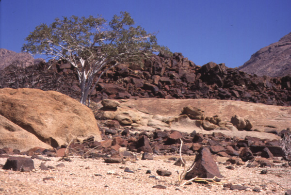 |
|
| Giraffes on horizon at Etosha | ||
| They insisted on waiting for us to continue down the road before they continued on their way to the local watering hole. Animals in the region spend much time migrating between watering holes as the springs dry up. Since there are no tall trees for hundreds of kilometers, (and haven't been for eons), I would surmize that longer necks also give giraffes a survival advantage because they can see predators further away. | 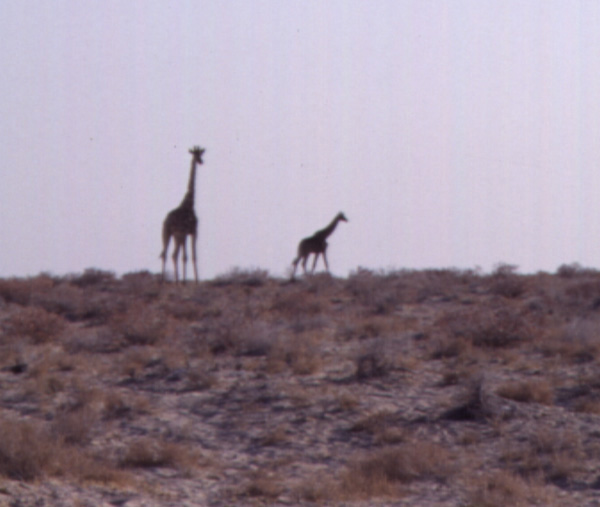 |
|
| Dr. Frank Eckardt, of the University of Botswana | ||
| A.k.a. The Pan Man, Dr. Frank's is an Earth Science researcher and lecturer at the University. His knowlege of the terrain proved crucial to the success of my mission. Note his cool JPL T-shirt, a gift from me. | 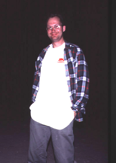 |
|
| Johan le Roux & son at the western edge of Etosha Pan | ||
| Johan suggested we look at this part of the pan after finding deep soft salts at the southern edge. Look closely and you will not see a groove in the pan surface from the weight of the truck. Note the extent of homogenous surface. Now, this is more like what we are used to! | 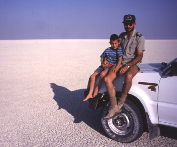 |
|
| Airborne view of Etosha Pan flying north of Gonob Peninsula | ||
| This area looked good from both the air and in satellite images, until we got down on the surface and found soft salt. Nothing like a calibrated Mark A-1 eyeball to check things out. | 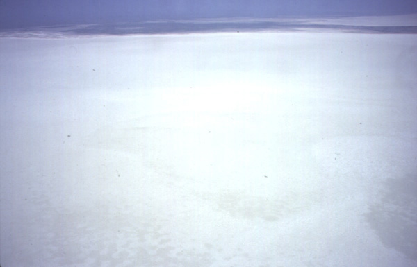 |
|
| Dr. Harold Annegarn at workshop meeting, Gaborone | ||
| Harold is the co-creator of SAFARI 2000 and works closely with Dr. Bob Swap to encourage and facilitate participation of the various African scientific communities in SAFARI 2000. Note thematic zebra-striped vest. | 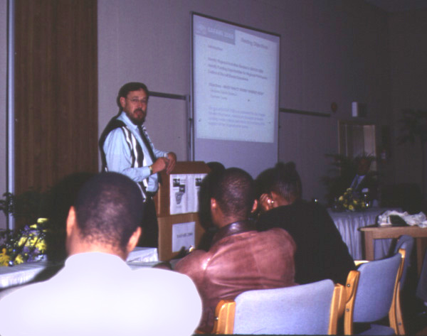 |
|
| Dr. Dr. Ned Brain, (a man with two PhD's) | ||
| World renown veterinarian of Etosha National Park and veteran of many documentaries. Can't you just hear the National Geographic theme playing in the background? He flew me all around the place and gave me a smooth ride. Thanks Ned! | 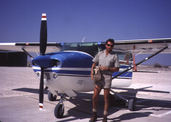 |
|
| Elephant spied from Dr. Dr. Brain's aeroplane | ||
| This is the kind of view one has when flying at “tusk height". Note radiotag tracking antenna on wing strut, and oh-no-not-him-again expression on elephant's face. | 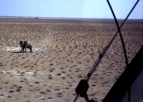 |
|
| Ostriches! | ||
| Found all over southern Africa, we almost hit these on the Trans-Kalahari Highway, on our way to Namibia from Gaborone. I guess the locals do not consider them good eating, there are too many running around. | 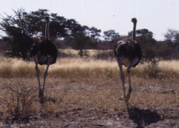 |
|
| Our tough little bukkie... | ||
| Hired from Buffalo Campers in Johannesburg, this doughty vehicle allowed Dr. Frank and I to explore Namibia without regard to how far we were from the next oasis of civilization. Note the tents on the roof. This discourages curious felines. | 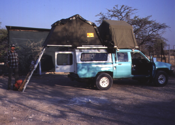 |
|
| Noisy connection | ||
| This is why cell phones are so popular. Land lines tend to be a bit noisy, especially when the bird nests get wet! This is a nest of society weaver birds. There can be hundreds of birds in a nest, and the nests can get a lot bigger than this one. | 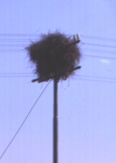 |
|
| Southwestern shoreline of Etosha Pan, west of Gonob Peninsula | ||
| Looks hard enough to drive on, but was not. Homogenous over a large area, but unusable. Note GPS antenna on corner of cab. Johan had a laptop inside plugged into the GPS displaying a Landsat Image of the region with a little red dot following us along on the screen. Very clever, and very useful in a landscape without reference features on the horizon! |  |
|
| Deep tracks into the Pan, somewhere near Gonob peninsula | ||
| This is why the Gonob area, on the southwestern shore of Etosha Pan, is unuseable. You don't want to get stuck out here. It's a race between the towtruck and the lions. There are stories of vehicles which had to be abandoned, and passengers who never made it out . . . |  |
|
| Mother and son, pumping gas | ||
| We stopped in a village along the Trans-Kalahari on the way back from Namibia to Gaborone, needing fuel badly. This was the second village just a few km off the main road we visited. Mom insisted, even though son was taking a break from the action. In southern Africa, you can't pump your own gas - you'll put someone out of a job. | 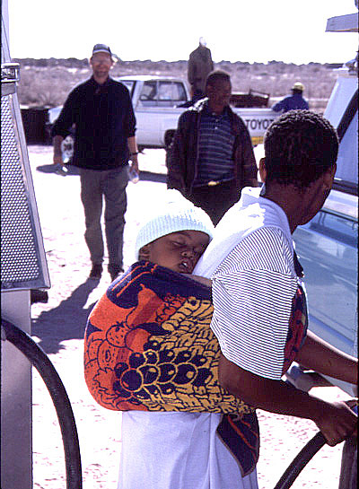 |
|