Steamboat Springs
March 8, 2001
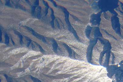
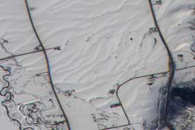
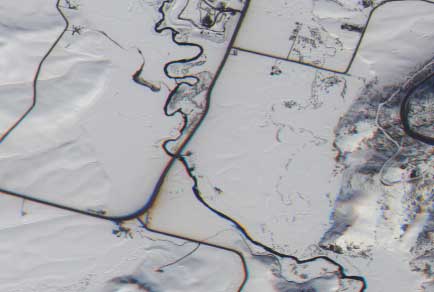
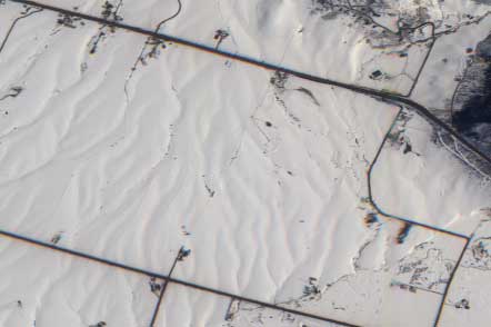
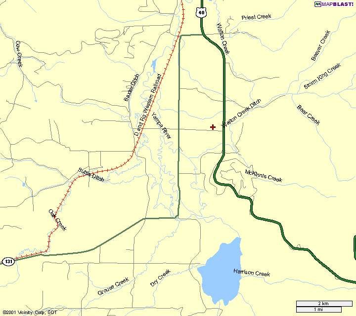
AirMISR overflew Steamboat Springs, Colorado today, at latitude 40.3992, longitude -106.8110. The experiment objective was to acquire snow and ice validation data. This was the last day of a six week campaign, and only the second cloud-free day. Because of the cloudy conditions, no MISR imagery were acquired during the campaign. JPL field data were acquired on this day, as well as one previous Saturday. With the AirMISR and field data, the experiment was considered a success.
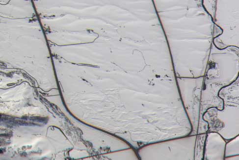
These images were constructed from raw AirMISR data, and represent our first look at these data. Geo-located and co-registered data will be made available in about two weeks time. Click on the thumb-nail images below to see an enlarged JPEG image, each about 150 KB in size.
 |
 |
 |
 |
Arizona border |
Terra path |
Run 3 - N/S into the Sun | Run 4 - E/W perpendicular to the Sun |
 |
 |
 |
 |
Terra path |
| Sortie No.: | 01-047 |
| Date: | March 8, 2001 |
| Takeoff (UTC): | 16:10 |
| Landing (UTC): | 21:15 |
| Pilot: | Broda |
| Aircraft: | 806 |
| Airfield: | Edwards AFB, CA (Dryden) |
| Nose: | 032 |
| Flt Req #: | 02043 (Anne Nolin) |
| Objective: | Steamboat Springs, CO (snow/ice albedo) |
| Other sensors: | MAS, RC-10, VIS |
| Cam.run file: | 2.0_2.0 |
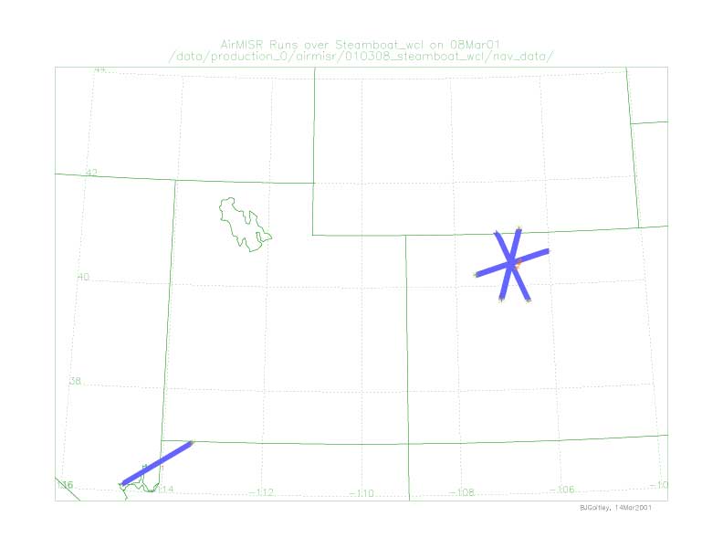
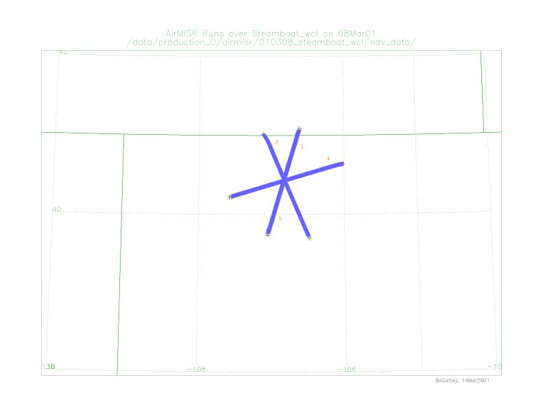
| Camera runs: | 5, as follows (times are approximate) |
| 1) 16:41 to 16:53 | operational check en-route, over Colorado river |
| 2) 17:52 to 18:04 | N-S along Terra track - 193.8 deg azimuth |
| 3) 18:21 to 18:33 | N-S, to sun |
| 4) 18:46 to 18:58 | E-W, perpendicular to sun line. Sun azimuth was 159.5 degrees. |
| 5) 19:05 to 10:17 | S-N, back along Terra track |
| Ramp runs: | none performed |
Pilot notes: Target was clear on all lines. Scattered cumulus on ridges surrounding site, and fog in Yampa valley to west of target. Light turbulence (pitching) on first two lines. Ground speed on lines varied due to winds aloft: 406, 430, 384, 414 knots respectively. Other obs: Instrument made all angles on all lines. Preliminary images look nominal. Ground team (MCH) was in place. No Terra overpass today. VIS and MAS also appears to have worked properly.
Recorded by: A. Cartledge
[Back] to Validation ResultsURL:
http://www-misr.jpl.nasa.gov/mission/valwork/val_reports/010308_steamboat
Update: March 9, 2001