Golden Day data sets are those in which simultaneous MISR and aircraft or in-situ
data were acquired simultaneously (postlaunch)
or experiment objectives met (prelaunch).
| Date | Site | Purpose | PI | Data sets acquired |
|---|---|---|---|---|
| 06Jun-30Jun01 Golden Data Set |
Rogers Dry Lake, Lunar Lake, and Railroad Valley | MISR Vicarious Calibration | Bruegge |
30Jun best data set. MISR, AirMISR, Landsat, AVIRIS data sets were acquired. Kurt Thome collected field data at both Railroad Valley and Lunar Lake Nevada. [Experiment summary] |
| 08Mar01 | Steamboat Springs, Colorado | Snow and Ice | Anne Nolin |
AirMISR, JPL in-situ including the Reagan, Cimel,
MFRSR, and PARABOLA. No MISR data acquired due to
cloudy conditions. |
| 13Aug01 - 25Sep01 Golden Data Set |
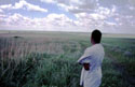
Southern Africa | Winter fire season | SAFARI 2000 | MISR, AirMISR, JPL in-situ [Experiment summary] |
| 11Jun00 Golden Data Set |
Lunar Lake, Nevada |
These data are used to provide the first Vicarious Calibration of MISR. | CalVal team | Three AirMISR overpasses of Lunar Lake were made on this day. Run 3 was co-incident with Terra overpass. Simultaneous satellite data were acquired from MISR, MODIS, Landsat, and IKONOS. Available in-situ data include Reagan, Cimel, MFRSR, and PARABOLA. See flight plan. |
| 12Mar00 Golden Data Set |
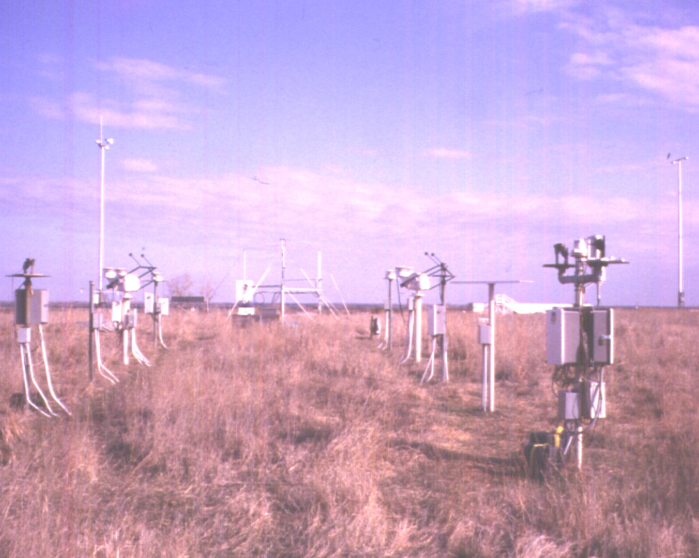
ARM site, Lamont, OK |
This experiment was designed to acquire clear sky observations in conjunction with the surface radiometers present at the ARM site in Lamont, Oklahoma. Conditions were hazy, with clouds moving in during the data acquisition. Nevertheless, a successful MISR, AirMISR, and field instrument comparison should be possible. See ARM summary report (4 MB PDF file) | John Martonchik | Four AirMISR overpasses were made on this day. The first two were the Terra ground track and back. Consecutive passes included the principal plane and its perpendicular. Concurrent ARM and JPL field instrumentation data were acquired. |
| 03Mar00 Golden Data Set |
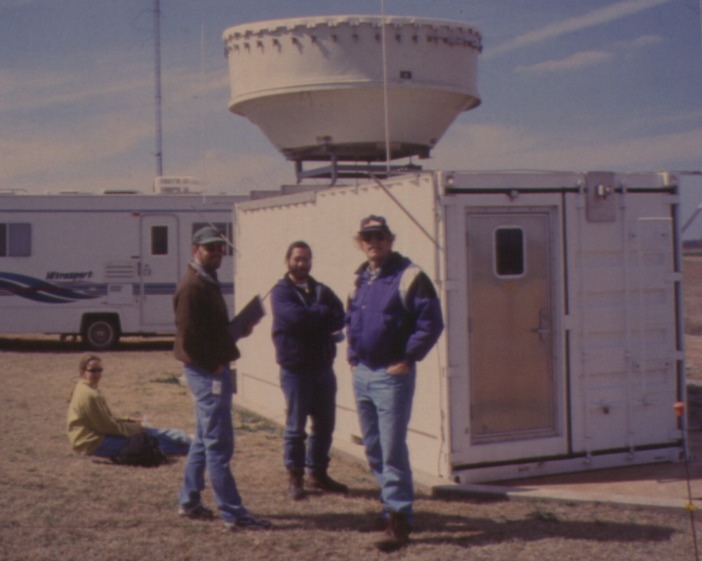
ARM site, Lamont, OK |
This experiment was designed to acquire cloud observations in conjunction with radars and lidars present at the ARM site in Lamont, Oklahoma. All objectives were met. See ARM summary report (4 MB PDF file) | Roger Marchand | Five AirMISR overpasses were made on this day. The first and last went North to acquire a clear scene over Wisconsin. Three runs were acquired over the ARM site, under cloudy skies. Concurrent observations with ARM instruments and the JPL PARABOLA and ASD were made. This is our first AirMISR flight with concurrent MISR data acquisition. |
| 19-22Oct99 Golden Data Set |
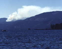 Lake Tahoe, CA |
The Lake Tahoe experiment was designed to acquire observations
of smoke, resulting from prescribed burns set by the California Parks and
Recreation Department, over deep waters of the lake. See Lake Tahoe summary report |
Val. team | 19Oct: made 6 AirMISR runs over the target. Concurrent with these, measurements were acquired from a cruise ship, the Tahoe Gal. These included observations using the PARABOLA, ASD, Reagan, Cimel,and MFRSR. |
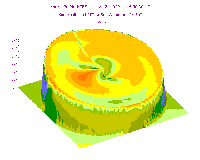
| 11-18Jul99 Golden Data Set |
 Konza Prairie LTER Manhattan , KS |
Konza Prairie Validation Experiment (KonVEx), the study of
vegetation bi-directional reflectance. See Konvex experiment summary report |
John Martonchik, Wedad Abdou, Ranga Myeni, David Meyer, Diane Wickland |
13Jul, AirMISR (Run#2 made target for all nine
angles); Continuous measurements from the Reagan, CIMEL, MFRSR. Samples of PARABOLA and ASD over burned/ unburned flat grassland; LAI/ FPAR and GPS data were acquired by the USGS. See also aerosol summary plot (PDF). |
| 30Jun99 | 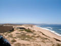 Marina, CA |
Cloud study
in conjunction with UARS; ER-2 runs 1,2: cloud deck (*); ER-2 runs 3,4: ground site with radar and sunphotometers (*) *=Terra flight path and orthogonal |
Graeme Stephens | UARS: Oxygen A sensor; AirMISR (ER-2); MODIS Airborne Simulator, MAS (ER2); Vertical profiles of particles (Twin Otter); Downwelling radiance and flux (Twin Otter); Radar (Twin Otter and ground site); Reagan, CIMEL, and MFRSR sunphotometers (at ground radar site). See also aerosol summary plot (PDF).. |
| 29Jun99 Golden Data Set |
Marina, CA |
Aerosol
retrieval over dark ocean; ER-2 runs 1,2: deep ocean about 12 miles off the coast (*); ER-2 runs 3,4: ground site with radar and sunphotometers (*); ER-2 run 5: cloud deck *=Terra flight path and orthogonal |
Ralph Kahn, John Martonchik, Roger Marchand |
AirMISR (ER-2); MODIS Airborne Simulator, MAS (ER2); Vertical profiles of particles (Twin Otter); Downwelling radiance and flux (Twin Otter); Radar (Twin Otter); Reagan, CIMEL, and MFRSR sunphotometers (at ground radar site); Ocean buoys (3). See also aerosol summary plot (PDF). |
| 07May99 | Tahoe City, CA | Aerosol retrieval over water | Val. team | Plot of aerosol
summary (PDF file) Go to Reagan results Go to MFRSR results Go to CIMEL results |
| 08Mar99 | 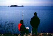 Buena Vista, CA |
Aerosol retrieval over water | Val. team | Plot of aerosol
summary (PDF file) Go to Reagan results Go to MFRSR results Go to CIMEL results |
| 11Dec98 Golden Data Set |
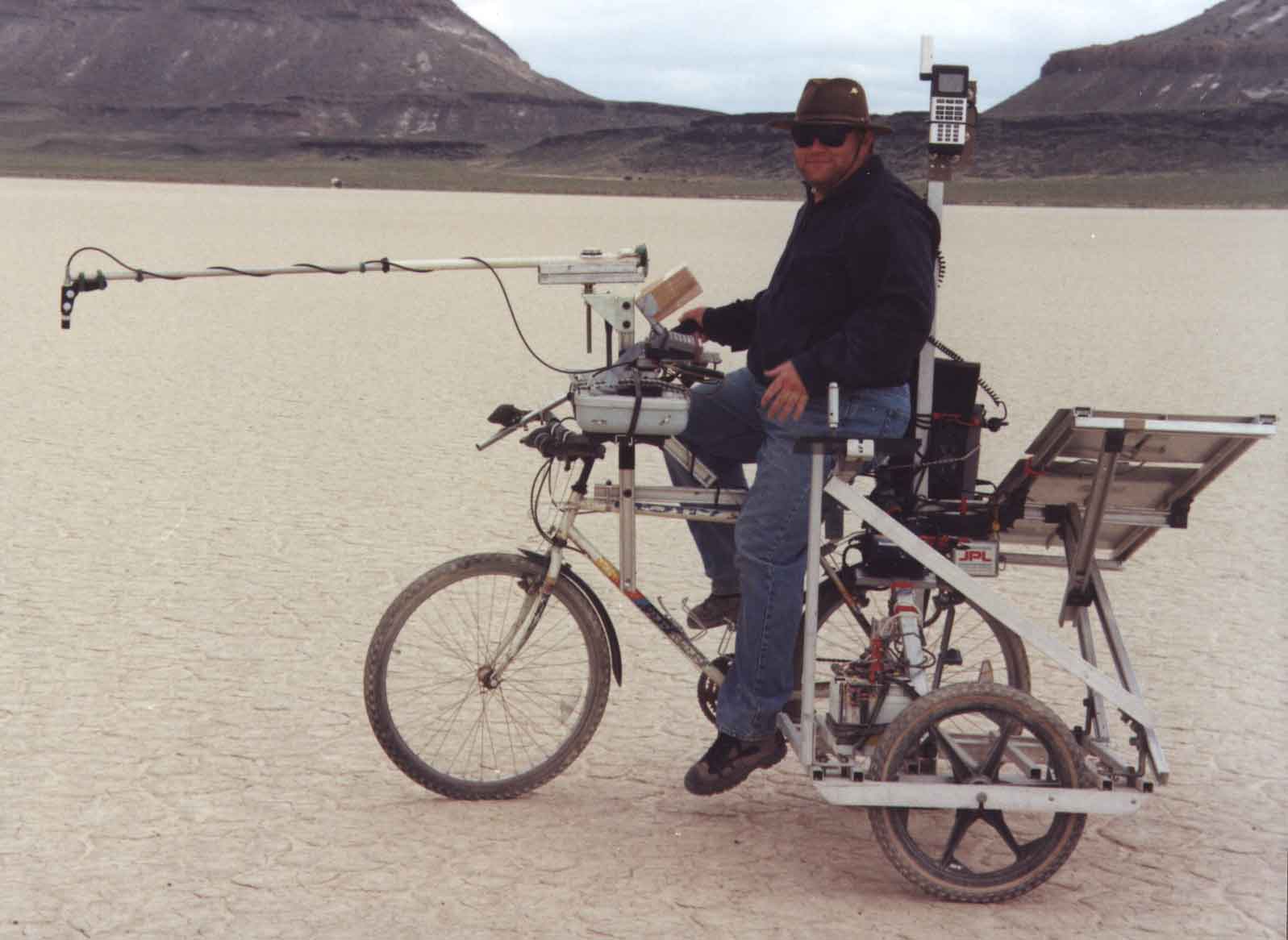
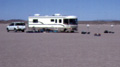 Roger's Dry Lake, CA |
AirMISR vicarious calibration | Val. team | AirMISR Flight #26, 6 runs (3 up and down passes); Complete complement of field data (Reagan, PARABOLA, CIMEL, MFRSR, ASD, photography); Conditions: clear, dry. Plot of aerosol summary (PDF file) Go to Reagan results Go to MFRSR results Go to CIMEL results Go to ASD results |
| 7-11Dec98 | Roger's Lake | Reagan sunphotometer calibrations | Val. team | The Reagan calibrations have been updated based upon four clear-day observations.
Dec. 8th was cloudy. Internal memorandum: sdfm#198 |
| 5Dec98 | JPL | AirMISR engineering check-out | Val. team | AirMISR Flight #24, 2 runs. Reagan sunphotometer on roof of JPL Bldg.
169; Conditions: clear, dry. |
| 29Jul- 10Aug98 |
Pacific Northwest | J. Conel | Internal sdfm#193; Sunphotometer data acquired. |
|
| Jun98 | Lunar Lake, Nevada | EOS intercomparison | EOS | MISR participation cancelled. AirMISR in undergoing refurbishment. |
| May98 | FIRE III | Arctic cloud detection/ sea ice site | Roger Marchand | 35 runs acquired; Success: good data set on June 3 |
| 10May98 | Rogers Dry Lake | Vicarious calibration over uniform target | Val. team | Internal memorandum: sdfm#169; Field data (Reagan and MFRSR) acquired. |
| 20Mar98 | JPL | Engineering check-out | CIMEL on roof | AirMISR and CIMEL co-incident data available. |
| 12Mar98 | Rogers Dry Lake | Vicarious calibration over uniform target | MISR validation team | AirMISR overpass. No field data - team at Mammoth. |
| 10Mar98 | Mono Lake, CA | Snow and ice studies | Anne Nolin | Internal memorandum: sdfm#176; Parabola data acquired Plot of aerosol summary (PDF file) Go to Reagan results Go to MFRSR results |
| 11Nov97 | Moffet field, CA | MISR engineering flight. Vicarious calibration procedure run-through. | MISR validation team. | AirMISR acquired imagery over hanger area. Co-incident sunphotometry acquired.
Surface characterized with the ASD a few days later. Publication submitted to Remote Sensing of Environment Plot of aerosol summary (PDF file) Go to ASD results |
| 8Aug97 | Moffett field | Engineering check-out | AirMISR flight. One complete run (9 cameras). | |
| 24Jun97 | Lunar Lake, NV | Joint vicarious calibration campaign | Kurt Thome | Plot of aerosol
summary (PDF file) Go to Reagan results Go to MFRSR results Go to CIMEL results Go to ASD results |
| 25-29May97 | Jornada, NM | sparse desert vegetation | Val. team | Reagan, PARABOLA, and MFRSR data acquired. |
| 11Apr97 | Moffett field | Engineering checkout | AirMISR flight. Acquired 4 camera images. | |
| 02Jun96 | Lunar Lake, NV | Joint vicarious calibration campaign | Kurt Thome, Steve Schiller, K. Arai, S. Tsuchida |
Results published in Metrologia, 35, 631-638, 1998. Internal memorandum: sdfm#85, 87, 90 Plot of aerosol summary (PDF file) Go to Reagan results Go to MFRSR results Go to ASD results |
| 4-6Aug94 | Table Mountain | Sunphotometer calibration |
Jump to:
Return to: Top of this page
AirMISR Campaign Schedule: [Fiscal
Year 2001 (GIF)] [Fiscal Year 2002 (PDF)]
AirMISR Flight
Log (JPL internal) (PDF file)
| Location |
Date (Products) |
Processing summary |
|---|---|---|
| Steamboat Springs, CO | 08 March 2001 (L1B2) | Runs 2 and 4 acquired the target |
| Kalahari, Namibia | 14 September 2000 | 14 runs |
| Namibia | 13 September 2000 | 8 runs |
| Kruger National Park | 07 September 2000 (L1B2) | 9 runs |
| Mongu Tower, Zambia | 06 September 2000 | 1 run |
| Lunar Lake, Nevada | 11 June 2000 (L1B1-geocal) (L1B2) | 3 runs acquired over Lunar Lake. Run 3 is syncronous with Terra. Data also processed to L1B1-geocal, that is the line number and sample are identified for a specific lat/ long location. |
| ARM, OK | 12 March 2000 | |
| ARM, OK | 03 March 2000 | |
| Konza Prairie, Kansas | 13 July 1999 (Nav) (L1B1) (L1B2) | Run 2 best run |
| Marina, CA | 29 June 1999 (Nav) (L1B1) (L1B2) | All 9 angles successfully acquired |
| Roger's Dry Lake, CA | 11 December 1998 (Nav) (L1B1) (L1B2) | Run 3 used for vicarious calibration study |
| JPL | 05 December 1998 (Nav) (L1B1) (L1B2) | |
| Barrow/Sheba | 06 June 1998 (Nav) (L1B1) (L1B2) | Runs 2,3, and 4 products only |
| Barrow/Sheba | 03 June 1998 (Nav) (L1B1) (L1B2) | Runs 2 and 3 products only |
| Mammoth | 10 March 1998 (Nav) (L1B1) (L1B2) | Bad flight line; run 1 Df image only |
| Moffett Field | 25 August 1997 (Nav) (L1B1) (L1B2) | Run 1 products only; only 2 images in run 2 |
| Location | Date |
|---|---|
| Konza LTER, KS | 13 July 1999 |
| Rogers Lake, CA | 11 December 1998 |
| Moffett Field, CA | 11 November 1997 |
| Lunar Lake, NV | 24 June 1997 |
| Lunar Lake, NV | 02 June 1996 |
| Location | Date |
|---|---|
| Steamboat Springs, CO | 08 Mar 2001 |
| Konza LTER, KS | 13 July 1999 |
| Marina, CA | 30 June 1999 |
| Marina, CA | 29 June 1999 |
| Tahoe City, CA | 07 May 1999 |
| Buena Vista, CA | 08 March 1999 |
| Rogers Lake, CA | 11 December 1998 |
| Lunar Lake, NV | 24 June 1997 |
| Location | Date |
|---|---|
| Steamboat Springs, CO | 08 Mar 2001 |
| Konza LTER, KS | 13 July 1999 |
| Marina, CA | 30 June 1999 |
| Marina, CA | 29 June 1999 |
| Tahoe City, CA | 07 May 1999 |
| Buena Vista, CA | 08 March 1999 |
| Rogers Lake, CA | 11 December 1998 |
| Mono Lake, CA | 10 March 1998 |
| Lunar Lake, NV | 24 June 1997 |
| Lunar Lake, NV | 02 June 1996 |
| Location | Date | ||
|---|---|---|---|
| Konza LTER (annually burned grass) |
|
||
| Rogers Lake, CA (desert playa) |
7-11 December 1998 | ||
| SNARL site, Mono Lake, CA (snow and ice) |
3, 10, 17-19 March 1998 | ||
| Moffet Field, CA (ER-2 hangar and concrete tarmac) |
12 November 1997 | ||
| Lunar Lake, NV (desert playa) |
24-27 June 1997 | ||
| Jornada (sparse desert vegetation) |
25-29 May 1997 | ||
| Ivanpah | 14 May 1997 |
| Location | Date (instrument) |
|---|---|
| Steamboat Springs, CO | 08 Mar 2001 (C) |
| Konza LTER, KS | 13 July 1999 (B) |
| Marina, CA | 30 June 1999 (B) |
| Marina, CA | 29 June 1999 (B) |
| Tahoe City, CA | 07 May 1999 (B) (C) |
| Buena Vista, CA | 08 March 1999 (C) |
| Rogers Lake, CA | 11 December 1998 (B) (C) |
| Mono Lake, CA | 10 March 1998 (B) (C) |
| Lunar Lake, NV | 24 June 1997 (C) |
| Lunar Lake, NV | 02 June 1996 (B) (C) |
Return to: Top of this page
Return to: Top of this page
![[Fiscal Year 2001 (GIF)]](val_reports/campaign_schedule.gif)