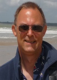
Science Team

Department of Earth and Environmental Studies
Montclair State University
Montclair, NJ 07043
Phone: 973.655.4448
Email: Click here
Mark Chopping
Mark Chopping received the M.Phil. in Remote Sensing & Geographical Information Systems from the University of Cambridge in 1995 and the Ph.D. in Remote Sensing from the University of Nottingham in 1998. From 1999 - 2002 he served as Physical Scientist with the Agricultural Research Service, United States Department of Agriculture; and from 2000 - 2007 as principal investigator in the ESA CHRIS/Proba mission (Data Exploitation Phase). In 2002 he joined the Department of Earth and Environmental Studies at Montclair State University, New Jersey, where he is Professor. He is currently a member of the NASA Multiangle Imaging Spectro-Radiometer (MISR), the NASA Arctic-Boreal Vulnerability Experiment (ABoVE) and the NASA Terrestrial Ecology science teams and has served as principal investigator in NASA's Earth Observing System (EOS) program and the multi-agency North American Carbon Program (NACP). He served on the NASA Land Cover Land Use Change Science Team from 2004 - 2008 and was appointed to the NASA Carbon Cycle & Ecosystems Vegetation Structure Working Group. His research interests include the interpretation of MISR and MODIS data with canopy reflectance and BRDF models to enable mapping of community type and woody plant canopy cover, height and aboveground woody biomass, with foci in arid and semi-arid regions, desert grasslands, western forests, and Arctic tundra. He also developed the Canopy ANAlysis with Panchromatic Imagery (CANAPI) family of codes for interpretation of high resolution imagery that has been used for forest and shrub canopy mapping, currently being used to map tall shrubs in Arctic tundra for ABoVE. His latest output is a 250 m interval MISR-based forest aboveground biomass dataset for the southwestern US over 2000 - 2021, validated with NACP and NASA CMS datasets.