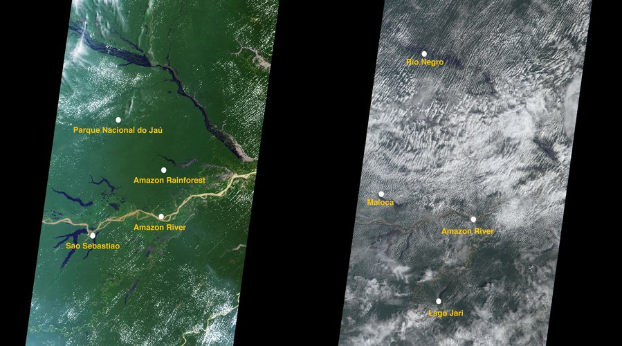
Dry and Wet Seasons in the Amazon Basin
The Amazon Basin covers 2,700,000 square miles (7,000,000 square kilometers), making it the largest drainage basin in the world. It occupies more than 40% of South America’s land area, and much of the basin is covered by dense tropical rainforest. These images from NASA's Multi-angle Imaging Spectroradiometer (MISR) contrast two predominant seasons of the Amazon Basin: dry and wet. Each season is approximately six months in duration. The image on the left was acquired July 24, 2021 (Terra orbit 114887, during the dry season), and the one on the right is from December 31 (Terra orbit 117217, during the wet season). Both are true-color composites, displaying data from the blue, green, and red bands of MISR’s nadir (vertical-viewing) camera. The driest month in the Amazon Basin is August, when the average rainfall is approximately 2 inches (5 centimeters). During the wet season, rainfall is greatest from December to May, and can exceed 8 inches (20 centimeters) per month. Over a year, the Amazon Basin averages an extraordinary 6 to 10 feet (1.8 to 3 meters) of rainfall. The Amazon rainforest recycles much of the annual rainfall back into the atmosphere. Data from another NASA instrument, the Tropical Emission Spectrometer (TES), have been used in isotopic analyses of atmospheric water vapor and indicate that the release of moisture from the Amazon rainforest back to the atmosphere hastens the onset of the wet season1.
1Wright, J.S. et al. (2017) Rainforest-initiated wet season onset over the southern Amazon. Proceedings of the National Academy of Sciences, 114 (32).
